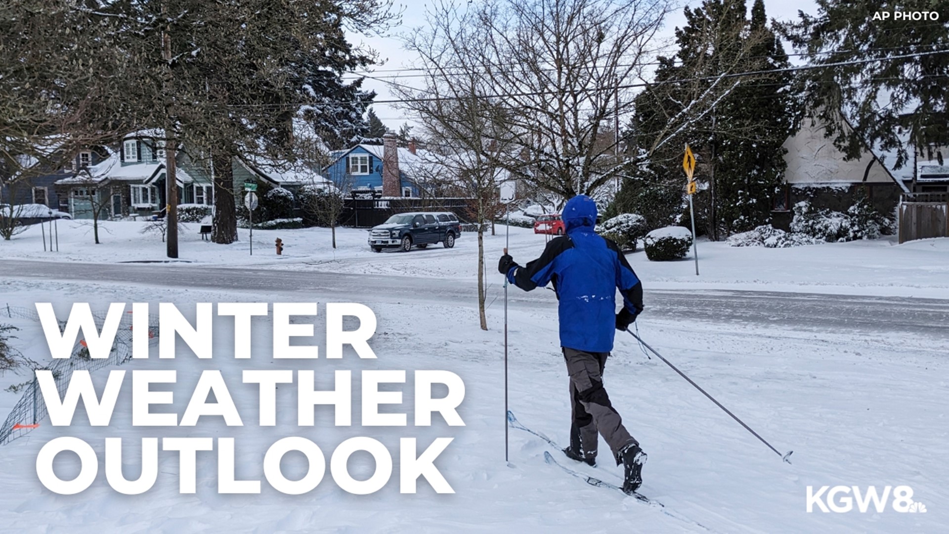
PORTLAND, Ore. — This winter's outlook is centered on the high-confidence projection from the National Oceanic and Atmospheric Administration (NOAA) that El Niño conditions will continue through March of 2024.
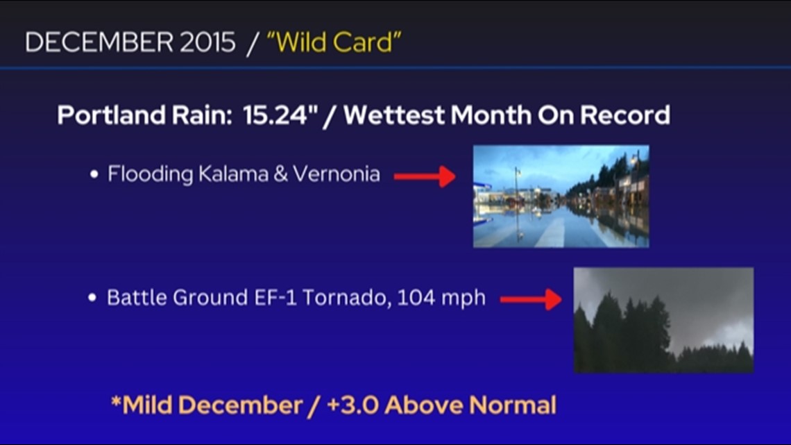
The most recent El Niño, back in 2015-2016, brought the wettest month on record for Portland, leading to flooding and one of the strongest tornadoes on record in Washington. Most of the time, however, El Niño winters, especially in the Pacific Northwest, are mild and dry.
What does that mean for this winter's weather? It looks to be a mild winter with higher-than-normal temperatures, very little snow in Portland and on the valley floor (as little as zero to three inches), a decent chance of a freezing rain storm, an elevated chance of high-wind episodes, below-average snow totals at Mount Hood and the chance of a slow start to the ski season through the holidays.

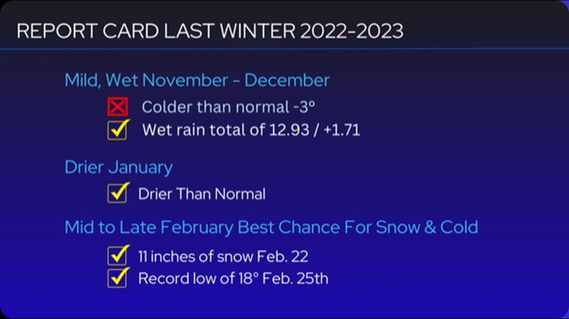
How I did with my winter outlook last year: Before we go any further, here's a recap of my winter outlook from last year. The most significant call was the projection for big snowstorms to take place in mid- to late-February.

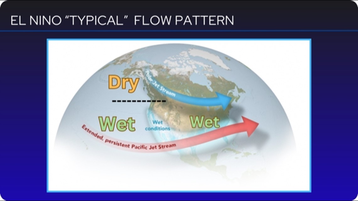
El Niño winters in the PNW are usually mild and dry: As mentioned, an El Niño winter is likely this winter. The typical El Niño flow pattern leads to an active, wet southern jet stream flow, bringing heavy rains to California and much of the southeastern United States. The northern jet stream tends to bring dry and mild ridging over the Pacific Northwest, while ushering cold Canadian air across the Great Lakes and Northeast.

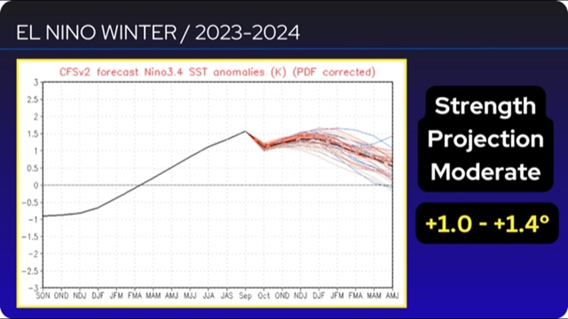
A moderate El Niño? A combination or spaghetti chart of weather models show equatorial water temperatures that define the El Niño cycle projected at 1.0 to 1.4 degrees Celsius above normal, defining a moderate event.

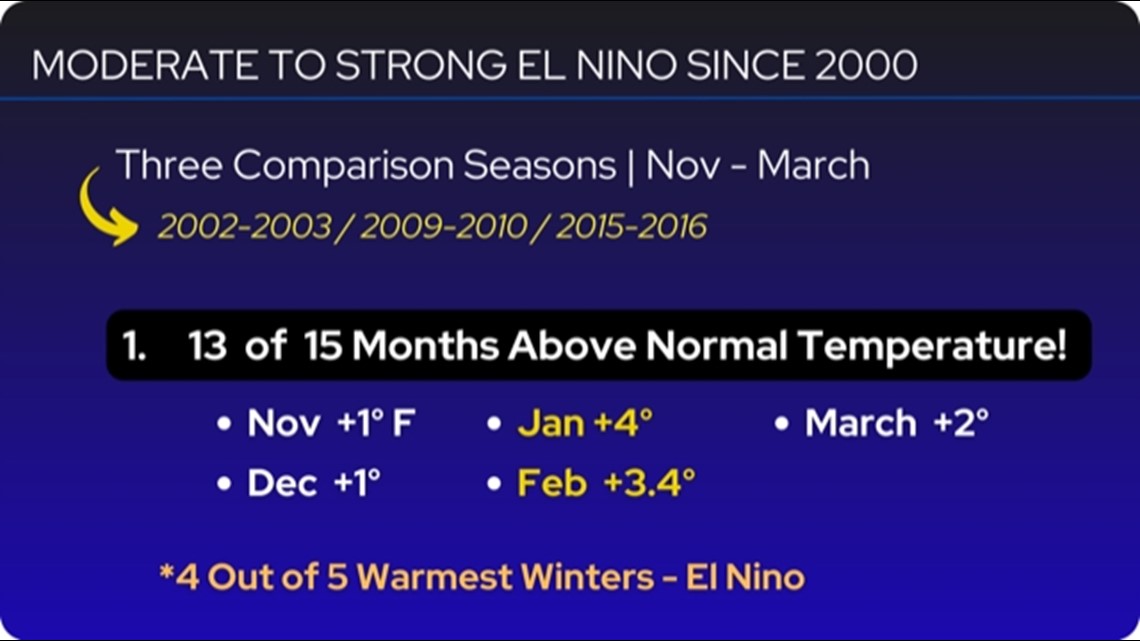
It looks like a mild winter: Here are my conclusions for the upcoming winter, leaning heavily on the comparison winters of 2002-2003, 2009-2010 and 2015-2016. Notice the winter or rainy season months of November to March show 13 of 15 months having above-normal mean temperatures. A mild winter is my highest confidence projection for this winter.

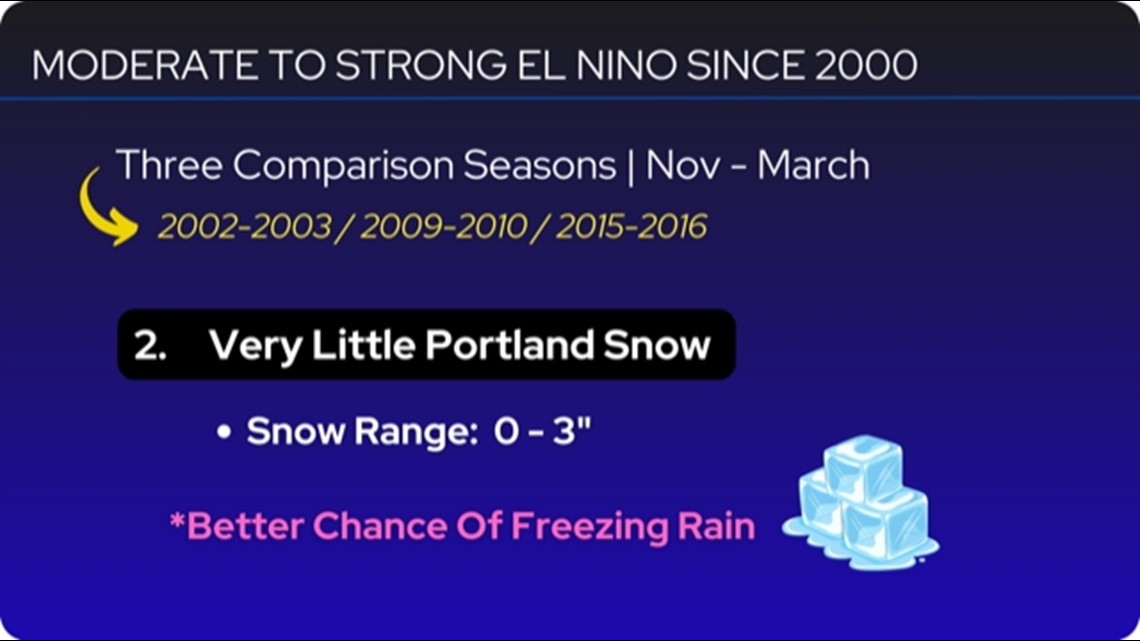
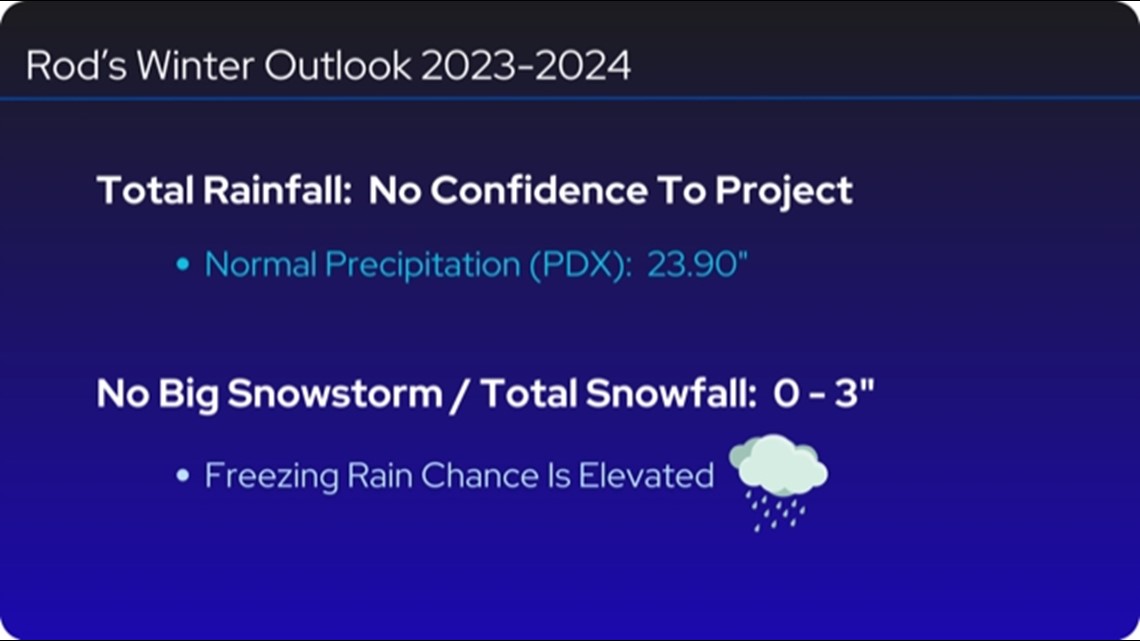
Little snow in the valley, but maybe an ice storm? My second forecast conclusion shows little Portland snow or zero to 3 inches of total valley floor snowfall. It is interesting to note that my research shows a better chance of freezing rain this winter than snow. Could we be in for an ice storm?

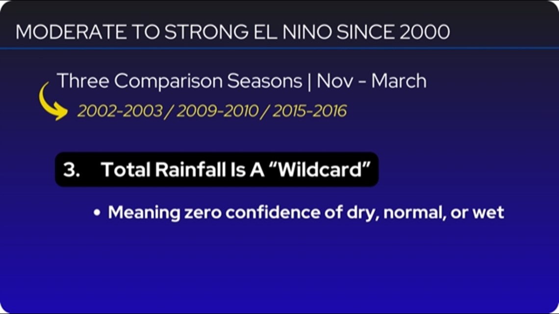
Precipitation totals are tough to call: Bulletin point three is my conclusion that data from past comparative El Niño years do not support the ability to project precipitation totals. Meaning I cannot make a call for a dry, wet or normal winter.

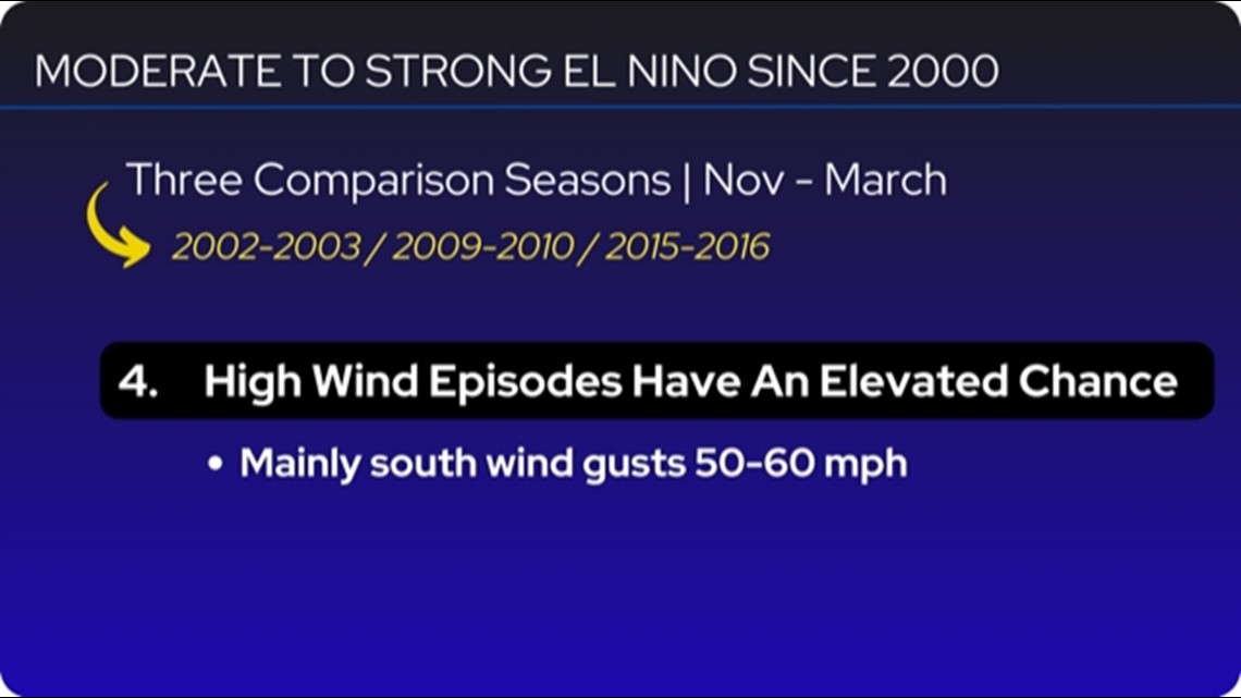
A bit of gusty wind: Finally, a fourth point shows an elevated chance for several south wind events with gusty winds in the valley reaching 50-60 mph. Nothing unusual here, simply an expected two to three south wind alert days.

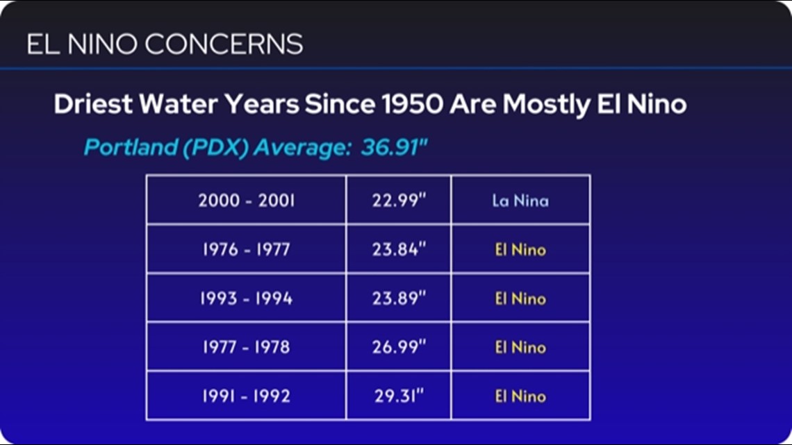
A dry winter is more likely than a wet one: Although I mentioned a no-confidence call to project total precipitation, El Niño winters are historically more dry than wet in terms of total statistics. There is always concern of an alarmingly dry season. Notice four of the five driest water years on record since 1950 are El Niño seasons.

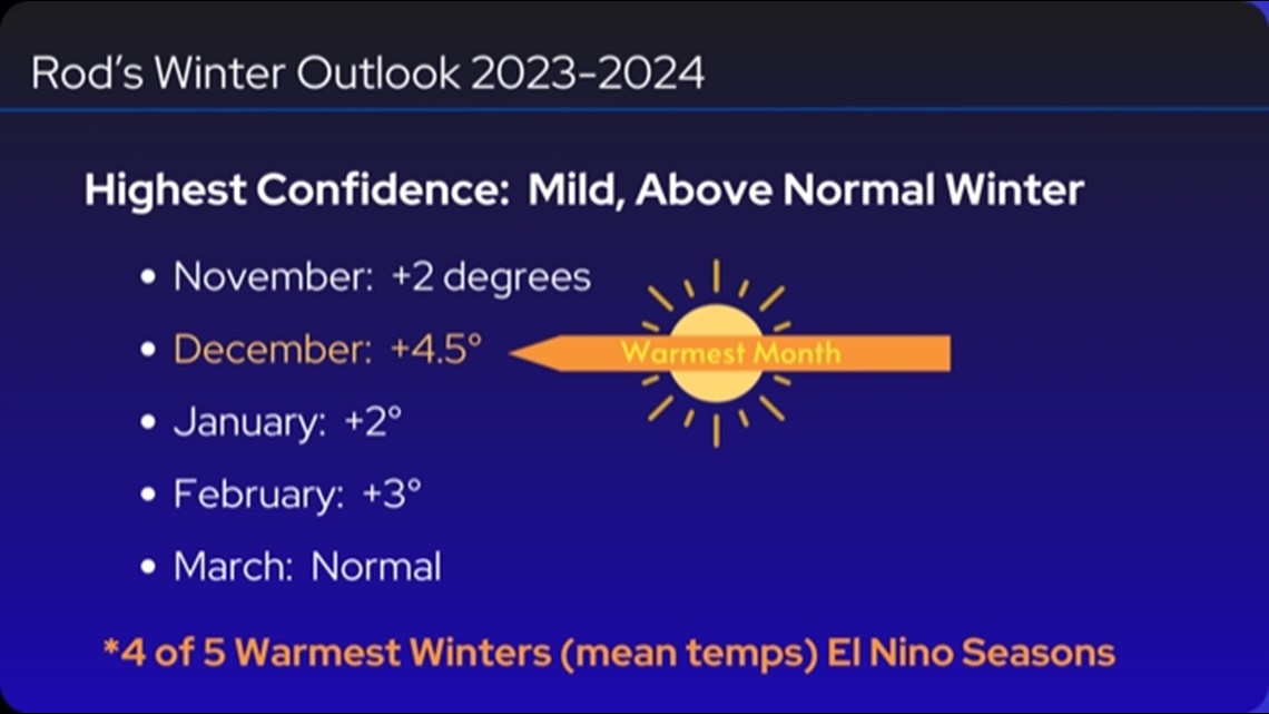
Expect a warm December: Here is my Winter Outlook for 2023-2024: A mild winter with December being the warmest month in terms of positive anomaly to climate average. A warm December would likely lead to higher-than-normal snow level in the Cascades and bring a near zero chance of low-level snow.

Little to no snow on the valley floor: As mentioned, no confidence to predict precipitation totals, but little to snow is expected. Data does support a decent chance to see a freezing rain event.

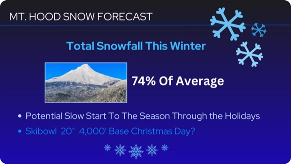
Below-normal snowpack in the mountains: Mount Hood snowpack is typically below normal in El Niño winters. Snow levels can reach 5,000 to 6,000 feet or higher more often than a so-called typical winter, meaning more high-elevation rain than better ski seasons would experience.

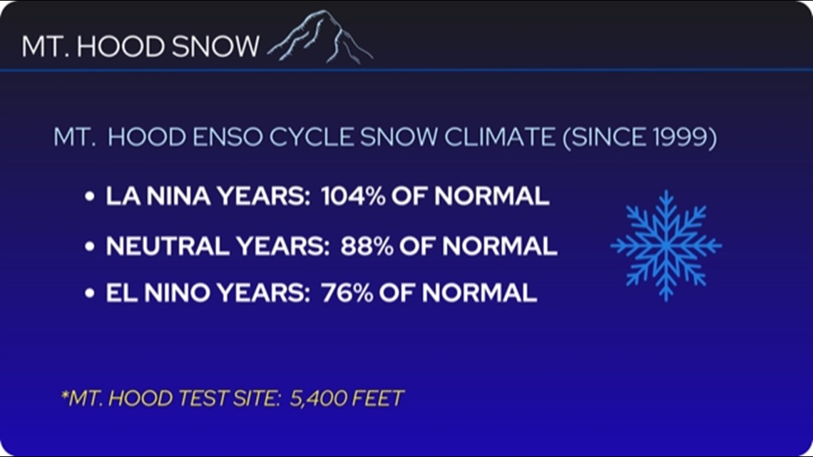
A slow start to the ski season? Mount Hood snowpack projection for this coming season is 74% of average. There is concern that ski season could get off to a slow start with less-than-ideal snowfall through the holiday season. Keep in mind the timing and quality of snow are often better indicators of a good recreation year than the amount measured in the snowpack come May 1 when the season ends.